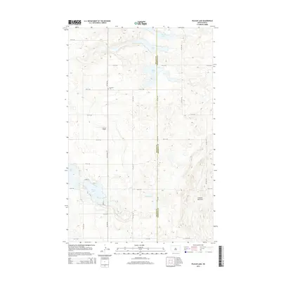
2014 Map of Pelican Lake
USGS Topo · Published 2014About this map
Our Savior Cem and the small Makeeff Airport sit amidst a glaciated landscape defined by an extensive network of prairie potholes and larger water bodies. The terrain is dominated by the Prophets Mountains in the southeast, while the county line between McLean and Sheridan counties cuts vertically through the center of the survey. The distribution of water is a primary feature here, with Pelican Lake, Brush Lake, and Howells Lake forming a chain across the region. A strict section-line road grid, including 12th St NW and 8th Ave NW, provides the framework for local travel between these wetlands, reflecting the organized agricultural development of the North Dakota plains.
Find a feature on this map
20 named features on this map. Tap any name to fly to it.
Don’t see what you’re looking for? This feature index may not catch every label — zoom into the map to look around manually.
Map Details
Editions of this 2014 Pelican Lake Map
This is the sole edition of this map. No revisions or reprints were ever made.
Other maps of this area

1945 · Pelican Lake
USGS Topo · 1:62,500

1947 · Pelican Lake
USGS Topo · 1:62,500

1947 · Turtle Lake
USGS Topo · 1:62,500

1949 · Turtle Creek
USGS Topo · 1:62,500

1954 · McClusky
USGS Topo · 1:250,000

1958 · McClusky
USGS Topo · 1:250,000

1959 · Pickardville
USGS Topo · 1:24,000

1959 · Mercer
USGS Topo · 1:24,000

1961 · Turtle Creek NE
USGS Topo · 1:24,000
1961 · Peterson Lake
USGS Topo · 1:24,000