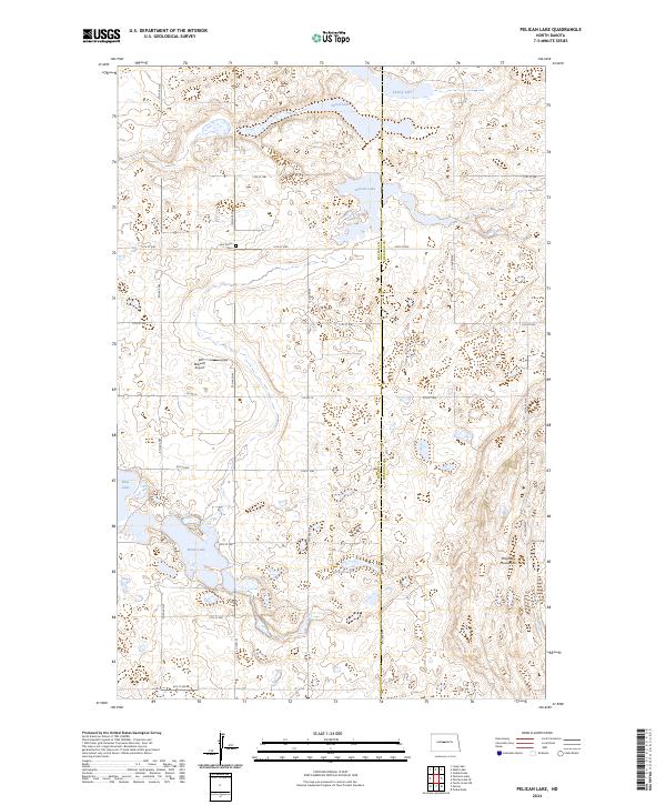
2024 Map of Pelican Lake
USGS Topo · Published 2024About this map
Pelican Lake and several other distinct prairie potholes dot this central North Dakota landscape along the boundary of McLean and Sheridan counties. The terrain is defined by the Prophets Mountains in the southeast and an extensive network of water bodies, including Postel Lake, Cherry Lake, and Howells Lake. Conservation efforts are prominent in the southwest corner, where the McLean County Waterfowl Production Area surrounds much of Brush Lake.
Find a feature on this map
26 named features on this map. Tap any name to fly to it.
Don’t see what you’re looking for? This feature index may not catch every label — zoom into the map to look around manually.
Map Details
Editions of this 2024 Pelican Lake Map
This is the sole edition of this map. No revisions or reprints were ever made.
Other maps of this area

1945 · Pelican Lake
USGS Topo · 1:62,500

1947 · Pelican Lake
USGS Topo · 1:62,500

1947 · Turtle Lake
USGS Topo · 1:62,500

1949 · Turtle Creek
USGS Topo · 1:62,500

1954 · McClusky
USGS Topo · 1:250,000

1958 · McClusky
USGS Topo · 1:250,000

1959 · Pickardville
USGS Topo · 1:24,000

1959 · Mercer
USGS Topo · 1:24,000

1961 · Turtle Creek NE
USGS Topo · 1:24,000
1961 · Peterson Lake
USGS Topo · 1:24,000