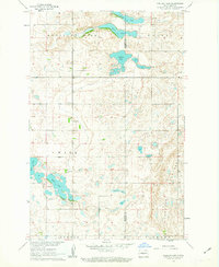
1961 Map of Pelican Lake
USGS Topo · Published 1963About this map
Prophets Mountain and the high ground of Medicine Hill overlook a landscape dominated by glacial prairie potholes and larger water bodies like Pelican Lake and Brush Lake. Situated along the boundary of McLean and Sheridan Counties, this 1961 survey captures a rural environment defined by its transition from high ridges to low-lying wetlands. The presence of Our Savior Cemetery and several district schools, such as School No 1 and School No 3, points to a sparse but established farming community.
Find a feature on this map
15 named features on this map. Tap any name to fly to it.
Don’t see what you’re looking for? This feature index may not catch every label — zoom into the map to look around manually.
Map Details
Editions of this 1961 Pelican Lake Map
This is the sole edition of this map. No revisions or reprints were ever made.
Other maps of this area

1945 · Pelican Lake
USGS Topo · 1:62,500

1947 · Pelican Lake
USGS Topo · 1:62,500

1947 · Turtle Lake
USGS Topo · 1:62,500

1949 · Turtle Creek
USGS Topo · 1:62,500

1954 · McClusky
USGS Topo · 1:250,000

1958 · McClusky
USGS Topo · 1:250,000

1959 · Pickardville
USGS Topo · 1:24,000

1959 · Mercer
USGS Topo · 1:24,000

1961 · Turtle Creek NE
USGS Topo · 1:24,000
1961 · Peterson Lake
USGS Topo · 1:24,000