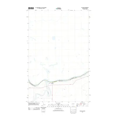
2013 Map of Pelland
USGS Topo · Published 2013About this map
Pelland sits at a geographic pivot point where the Little Fork River joins the Rainy River, marking the international boundary between Minnesota and Canada. This 2013 survey illustrates the northern frontier's transportation network, anchored by the junction of Us-71 and MN-11. These highways trace the riverbanks, serving as vital corridors in Koochiching County. The landscape south of the settlement is defined by local access routes such as Town Road 208, which navigates the low-lying terrain near the river fork. The map detail highlights the sparse, rural nature of the borderlands, where the water systems traditionally dictated the patterns of movement and habitation before being paralleled by the modern road system.
Find a feature on this map
11 named features on this map. Tap any name to fly to it.
Don’t see what you’re looking for? This feature index may not catch every label — zoom into the map to look around manually.
Map Details
Editions of this 2013 Pelland Map
This is the sole edition of this map. No revisions or reprints were ever made.
Other maps of this area

1919 · Pelland
USGS Topo · 1:62,500

1919 · Happy Land
USGS Topo · 1:62,500

1919 · International Falls
USGS Topo · 1:62,500

1954 · International Falls
USGS Topo · 1:250,000

1957 · International Falls
USGS Topo · 1:250,000

1958 · International Falls
USGS Topo · 1:250,000

1969 · Ericsburg NW
USGS Topo · 1:24,000
1969 · International Falls
USGS Topo · 1:24,000

1970 · Devlin
USGS Topo · 1:24,000
1970 · Littlefork
USGS Topo · 1:24,000