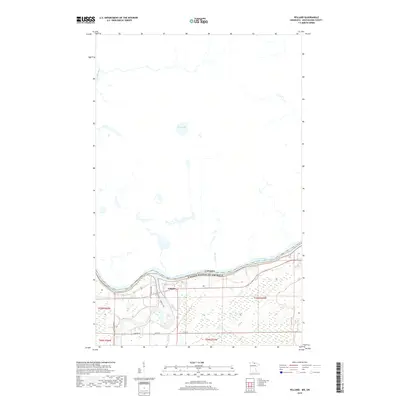
2019 Map of Pelland
USGS Topo · Published 2019About this map
The Rainy River defines the international boundary between the United States and Canada in this northern Koochiching County survey. Near the junction of the Little Fork River, the settlement of Pelland sits at a strategic point where local transportation routes like Town Rd 201 and Co Rd 79 converge. The landscape is characterized by extensive wetlands and water systems, including Kehl Lake and the meandering path of the La Vallée River flowing from the Canadian side. This mapping captures the rural infrastructure of the region, showing a network of township and utility roads such as Town Rd 398 and Ut Rd 202 that provide access to the low-lying, water-rich terrain along the border. The layout of the river systems illustrates the natural drainage patterns that have historically dictated settlement and transit in this remote borderland area.
Find a feature on this map
14 named features on this map. Tap any name to fly to it.
Don’t see what you’re looking for? This feature index may not catch every label — zoom into the map to look around manually.
Map Details
Editions of this 2019 Pelland Map
This is the sole edition of this map. No revisions or reprints were ever made.
Other maps of this area

1919 · Pelland
USGS Topo · 1:62,500

1919 · Happy Land
USGS Topo · 1:62,500

1919 · International Falls
USGS Topo · 1:62,500

1954 · International Falls
USGS Topo · 1:250,000

1957 · International Falls
USGS Topo · 1:250,000

1958 · International Falls
USGS Topo · 1:250,000

1969 · Ericsburg NW
USGS Topo · 1:24,000
1969 · International Falls
USGS Topo · 1:24,000

1970 · Devlin
USGS Topo · 1:24,000
1970 · Littlefork
USGS Topo · 1:24,000