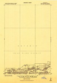
1919 Map of Pelland
USGS Topo · Published 1943About this map
The International Boundary follows the winding course of the Rainy River in this 1919 progressive military survey. The landscape is defined by the confluence of major northern waterways, where the Big Fork River and Little Fork River meet the international border. Along the southern banks, the Minnesota Dakota and Western railroad corridor anchors the early 20th-century economy, connecting riverside settlements such as Pelland, Laurel, and Chamberland. The map reveals a specific moment in the development of Koochiching County, showing the proximity of the Reedy area to the Canadian Rainy River District in Ontario. This sheet was specifically intended for field use by the Corps of Engineers, noting the presence of precise benchmarks and water surface elevations near Big Fork during the post-World War I era.
Find a feature on this map
13 named features on this map. Tap any name to fly to it.
Don’t see what you’re looking for? This feature index may not catch every label — zoom into the map to look around manually.
Map Details
Editions of this 1919 Pelland Map
2 editions found
Other maps of this area

1919 · Pelland
USGS Topo · 1:62,500

1919 · Happy Land
USGS Topo · 1:62,500

1919 · International Falls
USGS Topo · 1:62,500

1943 · Lindford
USGS Topo · 1:62,500

1954 · International Falls
USGS Topo · 1:250,000

1957 · International Falls
USGS Topo · 1:250,000

1958 · International Falls
USGS Topo · 1:250,000

1969 · Ericsburg NW
USGS Topo · 1:24,000
1969 · International Falls
USGS Topo · 1:24,000

1970 · Devlin
USGS Topo · 1:24,000