
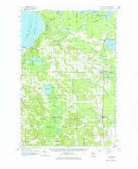
1958 Map of Pellston
USGS Topo · Published 1959About this map
Wilderness State Park anchors the northwestern corner of this Emmet County landscape, where the shoreline of Sturgeon Bay meets the extensive timberlands of the Hardwood State Forest. The mid-century settlement pattern is defined by small agricultural and forest communities like Levering, Bliss, and Pleasant View, often centered around country schoolhouses like Canby Sch and local churches. A notable institutional presence is the State Prison Camp located south of Larks Lake, reflecting the region's history of remote state-managed facilities.
Find a feature on this map
56 named features on this map. Tap any name to fly to it.
Don’t see what you’re looking for? This feature index may not catch every label — zoom into the map to look around manually.
Map Details
Editions of this 1958 Pellston Map
2 editions found
Other maps of this area

1955 · Cheboygan
USGS Topo · 1:250,000

1957 · Wolverine
USGS Topo · 1:62,500

1957 · Mullett Lake
USGS Topo · 1:62,500

1958 · Cheboygan
USGS Topo · 1:250,000

1958 · Cross Village
USGS Topo · 1:62,500

1958 · Bayshore
USGS Topo · 1:62,500

1958 · Petoskey
USGS Topo · 1:62,500

1964 · Big Stone Bay
USGS Topo · 1:24,000
1964 · St. Ignace
USGS Topo · 1:24,000
1964 · McGulpin Point
USGS Topo · 1:24,000