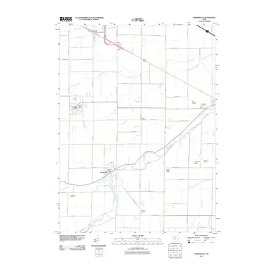
2010 Map of Pemberville
USGS Topo · Published 2010About this map
The Portage River serves as a central artery for this region of Northwest Ohio, where the North Branch Portage River converges near the village of Pemberville. This area is defined by a dense grid of rural roads and established cemeteries such as Eisenhour Cemetery and Troy Township Cemetery, which provide significant data points for genealogical research. The landscape transition is marked by geological features like Trimmers Ridge and Calers Ridge, while industrial activity is anchored at the Luckey Quarry northwest of Luckey.
Find a feature on this map
71 named features on this map. Tap any name to fly to it.
Don’t see what you’re looking for? This feature index may not catch every label — zoom into the map to look around manually.
Map Details
Editions of this 2010 Pemberville Map
This is the sole edition of this map. No revisions or reprints were ever made.
Other maps of this area

1900 · Maumee Bay
USGS Topo · 1:62,500

1900 · Toledo
USGS Topo · 1:62,500

1901 · Bowling Green
USGS Topo · 1:62,500

1901 · Elmore
USGS Topo · 1:62,500

1903 · Bowling Green
USGS Topo · 1:62,500

1903 · Elmore
USGS Topo · 1:62,500

1934 · Rossford
USGS Topo · 1:24,000

1935 · Walbridge
USGS Topo · 1:24,000

1935 · Genoa
USGS Topo · 1:24,000

1938 · Walbridge
USGS Topo · 1:31,680