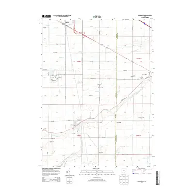
2013 Map of Pemberville
USGS Topo · Published 2013About this map
Pemberville and Woodville anchor this 2013 survey of the Wood and Sandusky County line, where the winding Portage River cuts through a landscape defined by glacial features and agricultural grids. The topography is subtly marked by elevations like Calers Ridge and Trimmers Ridge, which stand out against the drainage networks of Toussaint Cr and Martin Ditch. This era shows a well-developed road system, including the Fremont Pike and Middleton Pike, connecting smaller settlements such as Luckey and Lemoyne. Genealogists will find significant value in the documentation of numerous local burial sites, including the Troy Township Cem, Westwood Cem, and Eisenhour Cem. The map provides a precise look at the transition between town centers and rural farmland, capturing the exact layout of village streets like E Front St and Krotzer Ave as they existed at the start of the decade.
Find a feature on this map
112 named features on this map. Tap any name to fly to it.
Don’t see what you’re looking for? This feature index may not catch every label — zoom into the map to look around manually.
Map Details
Editions of this 2013 Pemberville Map
This is the sole edition of this map. No revisions or reprints were ever made.
Other maps of this area

1900 · Maumee Bay
USGS Topo · 1:62,500

1900 · Toledo
USGS Topo · 1:62,500

1901 · Bowling Green
USGS Topo · 1:62,500

1901 · Elmore
USGS Topo · 1:62,500

1903 · Bowling Green
USGS Topo · 1:62,500

1903 · Elmore
USGS Topo · 1:62,500

1934 · Rossford
USGS Topo · 1:24,000

1935 · Walbridge
USGS Topo · 1:24,000

1935 · Genoa
USGS Topo · 1:24,000

1938 · Walbridge
USGS Topo · 1:31,680