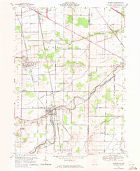
1969 Map of Pemberville
USGS Topo · Published 1971About this map
The Portage River flows through this 1969 landscape, providing a geographic anchor for the rural communities of Wood and Sandusky Counties. The survey reveals a region defined by agricultural parcels and the industrial presence of a Quarry and Sandpit. Small town centers like Pemberville and Luckey are meticulously detailed, showing the layout of residential streets and essential community institutions such as Zion Ch and Salem Ch.
Find a feature on this map
54 named features on this map. Tap any name to fly to it.
Don’t see what you’re looking for? This feature index may not catch every label — zoom into the map to look around manually.
Map Details
Editions of this 1969 Pemberville Map
This is the sole edition of this map. No revisions or reprints were ever made.
Other maps of this area

1900 · Maumee Bay
USGS Topo · 1:62,500

1900 · Toledo
USGS Topo · 1:62,500

1901 · Bowling Green
USGS Topo · 1:62,500

1901 · Elmore
USGS Topo · 1:62,500

1903 · Bowling Green
USGS Topo · 1:62,500

1903 · Elmore
USGS Topo · 1:62,500

1934 · Rossford
USGS Topo · 1:24,000

1935 · Walbridge
USGS Topo · 1:24,000

1935 · Genoa
USGS Topo · 1:24,000

1938 · Walbridge
USGS Topo · 1:31,680