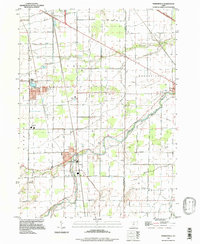
1994 Map of Pemberville
USGS Topo · Published 1998About this map
Pemberville and the winding Portage River define this portion of the Black Swamp region during the mid-1990s. The landscape is a structured grid of agricultural tracts and drainage efforts, visible in the numerous named channels like Toussaint Creek and the many ditches that crisscross Freedom and Troy townships. Settlement is concentrated in the established villages of Luckey, Woodville, and Lemoyne, which are connected by a network of rural routes such as Devils Hole Road and Sugar Ridge Road. Genealogists will find several burial sites preserved in this landscape, including the Pemberville Cemetery and Eisenhour Cem. The map captures a moment of modern infrastructure overlaid on traditional farmsteads, characterized by the path of the Ohio Turnpike in the north and various oil wells and substations scattered across the plains.
Find a feature on this map
51 named features on this map. Tap any name to fly to it.
Don’t see what you’re looking for? This feature index may not catch every label — zoom into the map to look around manually.
Map Details
Editions of this 1994 Pemberville Map
This is the sole edition of this map. No revisions or reprints were ever made.
Other maps of this area

1900 · Maumee Bay
USGS Topo · 1:62,500

1900 · Toledo
USGS Topo · 1:62,500

1901 · Bowling Green
USGS Topo · 1:62,500

1901 · Elmore
USGS Topo · 1:62,500

1903 · Bowling Green
USGS Topo · 1:62,500

1903 · Elmore
USGS Topo · 1:62,500

1934 · Rossford
USGS Topo · 1:24,000

1935 · Walbridge
USGS Topo · 1:24,000

1935 · Genoa
USGS Topo · 1:24,000

1938 · Walbridge
USGS Topo · 1:31,680