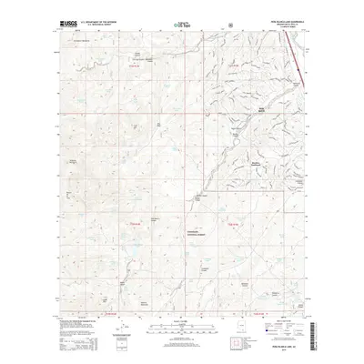
2014 Map of Pena Blanca Lake
USGS Topo · Published 2014About this map
Rio Rico and its surrounding desert landscapes are defined by high-elevation peaks and a complex network of watering holes in this 2014 survey. The topography is dominated by the Tumacacori Mountains to the northwest, the Atascosa Mountains to the west, and the Pajarito Mountains along the southern reach. Central to the area's hydrology is Peña Blanca Lake, supported by numerous named features such as Peña Blanca Spring and Rock Water Spring.
Find a feature on this map
136 named features on this map. Tap any name to fly to it.
Don’t see what you’re looking for? This feature index may not catch every label — zoom into the map to look around manually.
Map Details
Editions of this 2014 Pena Blanca Lake Map
This is the sole edition of this map. No revisions or reprints were ever made.
Other maps of this area

1904 · Patagonia
USGS Topo · 1:125,000

1905 · Patagonia
USGS Topo · 1:125,000

1905 · Nogales
USGS Topo · 1:125,000

1920 · Arivaca
USGS Topo · 1:125,000

1921 · Old Glory
USGS Topo · 1:125,000

1922 · Agus Caliente
USGS Topo · 1:62,500

1933 · Calabasas
USGS Topo · 1:62,500

1939 · Tubac
USGS Topo · 1:62,500

1942 · Ruby
USGS Topo · 1:62,500

1943 · Old Glory
USGS Topo · 1:125,000