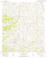
1981 Map of Pena Blanca Lake
USGS Topo · Published 1981About this map
The Coronado National Forest dominates this arid landscape of the Atascosa Mountains and Pajarito Mountains, centered on the recreational and utility hub of Peña Blanca Lake. The lake area is detailed with its Boat Ramp, Red Rock Picnic Area, and a Sewage Pond, indicating its role as a managed park site. Beyond the water, the map reveals a rugged terrain defined by cattle tanks and springs essential for ranching and wildlife, such as Mesa Side Tank and Waterfall Spring. Mining activity is recorded at the Morning Mine and St Patrick Mine in the southern hills, while a solitary Airstrip and a Patio Facility appear near the Luis Maria Baca Float No 3 grant boundary. The network of 4wd tracks and pipelines highlights the sparse but functional human presence across the canyons of Peña Blanca Lake.
Find a feature on this map
83 named features on this map. Tap any name to fly to it.
Don’t see what you’re looking for? This feature index may not catch every label — zoom into the map to look around manually.
Map Details
Editions of this 1981 Pena Blanca Lake Map
This is the sole edition of this map. No revisions or reprints were ever made.
Other maps of this area

1904 · Patagonia
USGS Topo · 1:125,000

1905 · Patagonia
USGS Topo · 1:125,000

1905 · Nogales
USGS Topo · 1:125,000

1920 · Arivaca
USGS Topo · 1:125,000

1921 · Old Glory
USGS Topo · 1:125,000

1922 · Agus Caliente
USGS Topo · 1:62,500

1933 · Calabasas
USGS Topo · 1:62,500

1939 · Tubac
USGS Topo · 1:62,500

1942 · Ruby
USGS Topo · 1:62,500

1943 · Old Glory
USGS Topo · 1:125,000