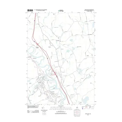
2012 Map of Penacook
USGS Topo · Published 2012About this map
The Merrimack River flows through this 2012 survey, defining the industrial and agricultural landscape of the Merrimack Valley north of the capital. In the south, the village of Penacook centers on the confluence with the Contoocook River, surrounded by residential developments like Concord Manor and recreational spaces such as the Beaver Meadow Golf Course. The map highlights the transition from the denser grid of Penacook to the upland farms and orchards of Canterbury.
Find a feature on this map
150 named features on this map. Tap any name to fly to it.
Don’t see what you’re looking for? This feature index may not catch every label — zoom into the map to look around manually.
Map Details
Editions of this 2012 Penacook Map
This is the sole edition of this map. No revisions or reprints were ever made.
Other maps of this area

1919 · Gilmanton
USGS Topo · 1:62,500

1921 · Suncook
USGS Topo · 1:62,500

1927 · Concord
USGS Topo · 1:62,500

1927 · Penacook
USGS Topo · 1:62,500

1927 · Gilmanton
USGS Topo · 1:62,500

1944 · Suncook
USGS Topo · 1:62,500

1949 · Portland
USGS Topo · 1:250,000

1949 · Concord
USGS Topo · 1:62,500

1956 · Penacook
USGS Topo · 1:62,500

1956 · Portland
USGS Topo · 1:250,000