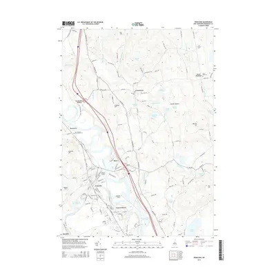
2015 Map of Penacook
USGS Topo · Published 2015About this map
Dustin Island sits at the confluence of the Merrimack River and the Contoocook River, marking a central point in this landscape of northern Concord and the surrounding towns. This survey illustrates the transition from the concentrated residential streets of Penacook and Concord Manor to the more open hillsides of Canterbury. The presence of Kezer Seminary and the New Hampshire State Veterans Cem highlights the area's institutional significance, while the numerous cemeteries like Woodlawn Cem and Zions Hill Cem provide essential data points for local genealogists. The map also reveals an intricate network of waterways, including the Merrimack River Reservoir and Turtle Pond, which define the low-lying areas between prominent elevations such as Cogswell Hill and Zion Hill. Local history is embedded in labels for places like Canterbury Station and Boyce, which denote former transport hubs along the river corridor.
Find a feature on this map
137 named features on this map. Tap any name to fly to it.
Don’t see what you’re looking for? This feature index may not catch every label — zoom into the map to look around manually.
Map Details
Editions of this 2015 Penacook Map
This is the sole edition of this map. No revisions or reprints were ever made.
Other maps of this area

1919 · Gilmanton
USGS Topo · 1:62,500

1921 · Suncook
USGS Topo · 1:62,500

1927 · Concord
USGS Topo · 1:62,500

1927 · Penacook
USGS Topo · 1:62,500

1927 · Gilmanton
USGS Topo · 1:62,500

1944 · Suncook
USGS Topo · 1:62,500

1949 · Portland
USGS Topo · 1:250,000

1949 · Concord
USGS Topo · 1:62,500

1956 · Penacook
USGS Topo · 1:62,500

1956 · Portland
USGS Topo · 1:250,000