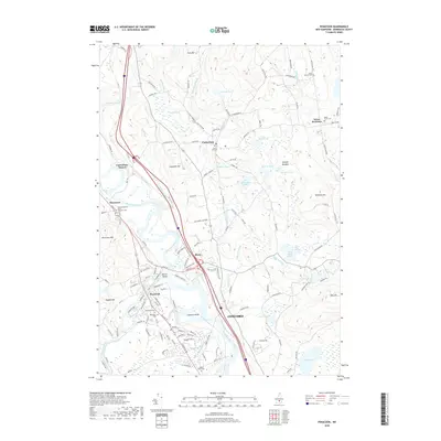
2018 Map of Penacook
USGS Topo · Published 2018About this map
The Merrimack River serves as the central artery for this region, winding past Dustin Island and the village of Penacook. This survey captures the complex intersection of river-dependent industry and modern infrastructure, where Sewalls Falls and Goodwin Point define the waterway's passage toward Concord. The landscape is dotted with generational markers, from the Kezer Seminary in the east to the New Hampshire State Veterans Cem near Boscawen. Small settlements like Boyce and Canterbury Station anchor the rail and road corridors that follow the river valley. To the north and west, the terrain rises into named heights such as Zion Hill and Cogswell Hill, interspersed with numerous wetlands and water bodies including Morrill Pond and Kimball Pond, reflecting a landscape that balances historic upland farming with conserved natural areas.
Find a feature on this map
138 named features on this map. Tap any name to fly to it.
Don’t see what you’re looking for? This feature index may not catch every label — zoom into the map to look around manually.
Map Details
Editions of this 2018 Penacook Map
This is the sole edition of this map. No revisions or reprints were ever made.
Other maps of this area

1919 · Gilmanton
USGS Topo · 1:62,500

1921 · Suncook
USGS Topo · 1:62,500

1927 · Concord
USGS Topo · 1:62,500

1927 · Penacook
USGS Topo · 1:62,500

1927 · Gilmanton
USGS Topo · 1:62,500

1944 · Suncook
USGS Topo · 1:62,500

1949 · Portland
USGS Topo · 1:250,000

1949 · Concord
USGS Topo · 1:62,500

1956 · Penacook
USGS Topo · 1:62,500

1956 · Portland
USGS Topo · 1:250,000