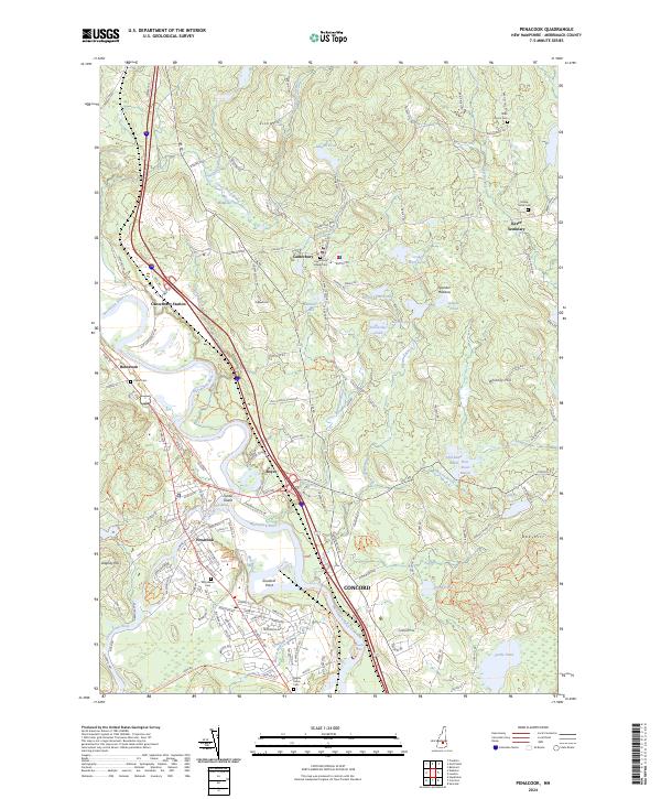
2024 Map of Penacook
USGS Topo · Published 2024About this map
The confluence of the Contoocook River and the Merrimack River anchor this landscape, where the historical village of Penacook borders the northern reaches of Concord. The terrain is shaped by the glacial legacy of central New Hampshire, featuring numerous small bodies of water like Horseshoe Pond and Hothole Pond, alongside named elevations such as Zion Hill and Oak Hill. The presence of the Northern Rail Trl follows the old rail corridor through Boscawen, tracing a path near Canterbury Station that once served the rural economy.
Find a feature on this map
148 named features on this map. Tap any name to fly to it.
Don’t see what you’re looking for? This feature index may not catch every label — zoom into the map to look around manually.
Map Details
Editions of this 2024 Penacook Map
This is the sole edition of this map. No revisions or reprints were ever made.
Other maps of this area

1919 · Gilmanton
USGS Topo · 1:62,500

1921 · Suncook
USGS Topo · 1:62,500

1927 · Concord
USGS Topo · 1:62,500

1927 · Penacook
USGS Topo · 1:62,500

1927 · Gilmanton
USGS Topo · 1:62,500

1944 · Suncook
USGS Topo · 1:62,500

1949 · Portland
USGS Topo · 1:250,000

1949 · Concord
USGS Topo · 1:62,500

1956 · Penacook
USGS Topo · 1:62,500

1956 · Portland
USGS Topo · 1:250,000