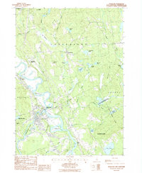
1987 Map of Penacook
USGS Topo · Published 1987About this map
The Merrimack River flows south through the center of this landscape, marking the convergence with the Contoocook River at the village of Penacook. This area shows a transition from the industrial and residential settlement at Penacook to the more rural, pond-dotted terrain of Canterbury and Boscawen. Significant landmarks include the Hannah Dustin Historical Site on a small island in the river and the Sewalls Falls reach to the south. The map documents the region's environmental preservation through the Hirst State Wildlife Management Area and Ayers State Forest. Numerous water bodies, such as Snow Pond, Turtle Pond, and Crane Neck Pond, characterize the upland areas away from the river valley, while former transportation hubs like Canterbury Station and Northfield Sta indicate the importance of the rail corridor through the valley.
Find a feature on this map
46 named features on this map. Tap any name to fly to it.
Don’t see what you’re looking for? This feature index may not catch every label — zoom into the map to look around manually.
Map Details
Editions of this 1987 Penacook Map
This is the sole edition of this map. No revisions or reprints were ever made.
Other maps of this area

1919 · Gilmanton
USGS Topo · 1:62,500

1921 · Suncook
USGS Topo · 1:62,500

1927 · Concord
USGS Topo · 1:62,500

1927 · Penacook
USGS Topo · 1:62,500

1927 · Gilmanton
USGS Topo · 1:62,500

1944 · Suncook
USGS Topo · 1:62,500

1949 · Portland
USGS Topo · 1:250,000

1949 · Concord
USGS Topo · 1:62,500

1956 · Penacook
USGS Topo · 1:62,500

1956 · Portland
USGS Topo · 1:250,000