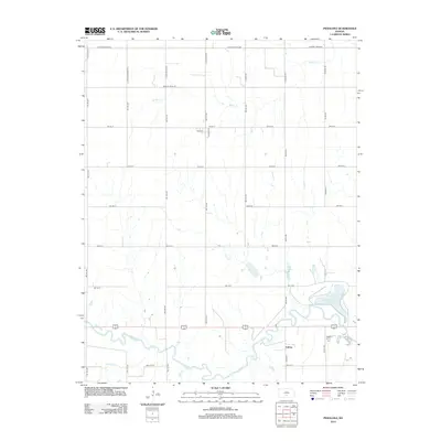
2012 Map of Penalosa
USGS Topo · Published 2012About this map
The S Fork Ninnescah River meanders across the southern portion of this landscape, defining the character of the countryside near the community of Calista. North of the river, the landscape is marked by the expansive Kingman County State Lake, a significant water feature and recreational landmark for the region. The drainage patterns are further established by tributaries such as Goose Cr, Mead Cr, and Painter Cr, which cut through the strictly organized agricultural grid. A network of county roads, including W Maple Grove Rd and S Langdon Rd, follows section lines, reflecting the enduring legacy of the public land survey system in Kingman County. This 2012 survey illustrates a transition where prairie watercourses and modern infrastructure meet, preserving the location of local crossroads and rural water bodies as they appeared in the early 21st century.
Find a feature on this map
37 named features on this map. Tap any name to fly to it.
Don’t see what you’re looking for? This feature index may not catch every label — zoom into the map to look around manually.
Map Details
Editions of this 2012 Penalosa Map
This is the sole edition of this map. No revisions or reprints were ever made.
Other maps of this area

1892 · Kingman
USGS Topo · 1:125,000

1894 · Kingman
USGS Topo · 1:125,000

1955 · Pratt
USGS Topo · 1:250,000

1959 · Pratt
USGS Topo · 1:250,000

1966 · Cunningham
USGS Topo · 1:24,000
1966 · St Leo
USGS Topo · 1:24,000

1967 · Kingman NW
USGS Topo · 1:24,000

1967 · Cleveland
USGS Topo · 1:24,000
1967 · Willowdale
USGS Topo · 1:24,000

1967 · Penalosa
USGS Topo · 1:24,000