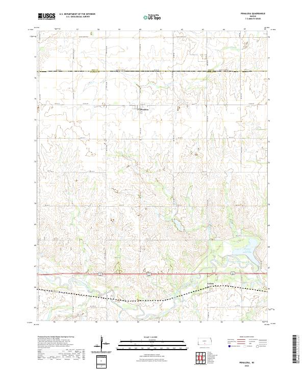
2022 Map of Penalosa
USGS Topo · Published 2022About this map
Penalosa serves as the focal point of this rural Kansas landscape, where the agricultural grid of Kingman County meets the meandering path of the South Fork Ninnescah River. The terrain is defined by the drainage patterns of Goose Cr, Painter Cr, and Mead Cr, which carve through the plains south of the Reno Co Kingman Co border. A significant landmark in the southeastern portion of the quadrangle is Kingman County State Lake, providing a distinct geographic break from the surrounding section lines and range roads. The small settlement of Calista sits further east along the river valley, connected by a network of local routes including Smoots Creek Rd and Maple Grove Rd. This map illustrates the persistence of the township-and-range system, with roads like NW 60 St and NW 30 St marking the regular intervals of the High Plains agricultural tradition.
Find a feature on this map
28 named features on this map. Tap any name to fly to it.
Don’t see what you’re looking for? This feature index may not catch every label — zoom into the map to look around manually.
Map Details
Editions of this 2022 Penalosa Map
This is the sole edition of this map. No revisions or reprints were ever made.
Other maps of this area

1892 · Kingman
USGS Topo · 1:125,000

1894 · Kingman
USGS Topo · 1:125,000

1955 · Pratt
USGS Topo · 1:250,000

1959 · Pratt
USGS Topo · 1:250,000

1966 · Cunningham
USGS Topo · 1:24,000
1966 · St Leo
USGS Topo · 1:24,000

1967 · Kingman NW
USGS Topo · 1:24,000

1967 · Cleveland
USGS Topo · 1:24,000
1967 · Willowdale
USGS Topo · 1:24,000

1967 · Penalosa
USGS Topo · 1:24,000