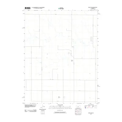
2009 Map of Pence NW
USGS Topo · Published 2009About this map
Chalk Creek meanders through this agricultural landscape in Wichita County, providing a primary drainage feature for the surrounding High Plains terrain. The region is defined by a rigorous grid of section lines and gravel roads, including Dakota and Marienthal Rd, which connect isolated farmsteads and agricultural holdings. The presence of private aviation infrastructure, such as the Kough Landing Strip and the RWR Landing Strip, highlights the practical importance of light aircraft for managing large-scale farming operations and reaching distant centers in western Kansas. The map documents a sparsely populated but highly organized rural environment where transportation routes like Adobe Rd and various numbered county roads dictate the pattern of movement and land use.
Find a feature on this map
14 named features on this map. Tap any name to fly to it.
Don’t see what you’re looking for? This feature index may not catch every label — zoom into the map to look around manually.
Map Details
Editions of this 2009 Pence NW Map
This is the sole edition of this map. No revisions or reprints were ever made.
Other maps of this area

1939 · Pence
USGS Topo · 1:62,500

1941 · Pence
USGS Topo · 1:62,500

1955 · Scott City
USGS Topo · 1:250,000

1958 · Scott City
USGS Topo · 1:250,000

1968 · Russell Springs 3 SE
USGS Topo · 1:24,000

1968 · Russell Springs 3 NE
USGS Topo · 1:24,000

1969 · Russell Springs 2 SE
USGS Topo · 1:24,000
1974 · Lone Butte
USGS Topo · 1:24,000
1974 · Russell Springs SE
USGS Topo · 1:24,000
1976 · Pence
USGS Topo · 1:24,000