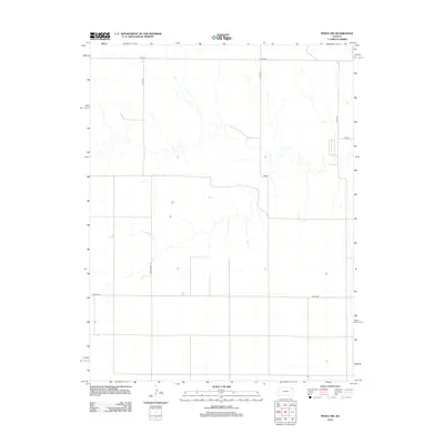
2012 Map of Pence NW
USGS Topo · Published 2012About this map
The High Plains landscape of Wichita County is defined by a rigorous orthogonal road network that organizes this agricultural region. Major thoroughfares such as Marienthal Rd and Pence Rd cut across the territory, providing essential links for the scattered farmsteads and rural properties shown on the sheet. The terrain is marked by seasonal drainages that meander across the plains, contrasting with the straight-line precision of section-line roads like Dakota and Bison. Small clusters of structures appear periodically, often associated with the intersection of local routes such as Co Rd 270 and Adobe. This survey reflects the enduring grid-based settlement pattern of Western Kansas, where land use is dictated by the availability of water and the accessibility of these critical transportation corridors.
Find a feature on this map
8 named features on this map. Tap any name to fly to it.
Don’t see what you’re looking for? This feature index may not catch every label — zoom into the map to look around manually.
Map Details
Editions of this 2012 Pence NW Map
This is the sole edition of this map. No revisions or reprints were ever made.
Other maps of this area

1939 · Pence
USGS Topo · 1:62,500

1941 · Pence
USGS Topo · 1:62,500

1955 · Scott City
USGS Topo · 1:250,000

1958 · Scott City
USGS Topo · 1:250,000

1968 · Russell Springs 3 SE
USGS Topo · 1:24,000

1968 · Russell Springs 3 NE
USGS Topo · 1:24,000

1969 · Russell Springs 2 SE
USGS Topo · 1:24,000
1974 · Lone Butte
USGS Topo · 1:24,000
1974 · Russell Springs SE
USGS Topo · 1:24,000
1976 · Pence
USGS Topo · 1:24,000