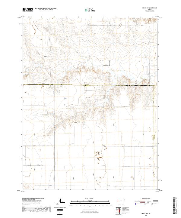
2022 Map of Pence NW
USGS Topo · Published 2022About this map
Logan Co Wichita Co defines the northern reaches of this high plains landscape, where the survey lines of the Public Land Survey System dictate the movement of travelers and the division of territory. The vast, open terrain is partitioned by a rigid grid of section lines and gravel paths, including Adobe Rd and Bison Rd. This 2022 survey captures the modern agricultural geometry of western Kansas, where long-distance routes like Co Rd 270 and Co Rd 19 connect isolated farmsteads across the township lines of t15s r35w and t16s r35w.
Find a feature on this map
24 named features on this map. Tap any name to fly to it.
Don’t see what you’re looking for? This feature index may not catch every label — zoom into the map to look around manually.
Map Details
Editions of this 2022 Pence NW Map
This is the sole edition of this map. No revisions or reprints were ever made.
Other maps of this area

1939 · Pence
USGS Topo · 1:62,500

1941 · Pence
USGS Topo · 1:62,500

1955 · Scott City
USGS Topo · 1:250,000

1958 · Scott City
USGS Topo · 1:250,000

1968 · Russell Springs 3 SE
USGS Topo · 1:24,000

1968 · Russell Springs 3 NE
USGS Topo · 1:24,000

1969 · Russell Springs 2 SE
USGS Topo · 1:24,000
1974 · Lone Butte
USGS Topo · 1:24,000
1974 · Russell Springs SE
USGS Topo · 1:24,000
1976 · Pence
USGS Topo · 1:24,000