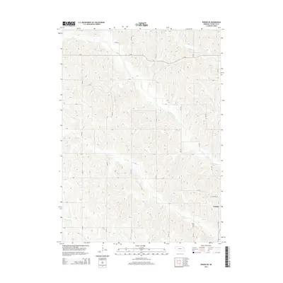
2014 Map of Pender NE
USGS Topo · Published 2014About this map
Walthill marks the southeastern corner of this Nebraska landscape, where the town's grid meets the agricultural reaches of Thurston County. The terrain is defined by a dense network of drainage systems, including the wandering paths of N Omaha Cr, Cow Cr, and Morgan Cr. This 2014 survey documents a mature rural infrastructure of section-line roads, such as Mathewson Rd and Balltown Rd, that navigate the undulating loess hills typical of this Missouri River upland region.
Find a feature on this map
24 named features on this map. Tap any name to fly to it.
Don’t see what you’re looking for? This feature index may not catch every label — zoom into the map to look around manually.
Map Details
Editions of this 2014 Pender NE Map
This is the sole edition of this map. No revisions or reprints were ever made.
Other maps of this area

1955 · Sioux City
USGS Topo · 1:250,000

1958 · Sioux City
USGS Topo · 1:250,000

1959 · Sioux City
USGS Topo · 1:250,000

1964 · Homer
USGS Topo · 1:24,000

1966 · Walthill SW
USGS Topo · 1:24,000

1966 · Walthill
USGS Topo · 1:24,000
1966 · Bancroft
USGS Topo · 1:24,000

1966 · Thurston
USGS Topo · 1:24,000

1966 · Pender NE
USGS Topo · 1:24,000
1966 · Pender
USGS Topo · 1:24,000