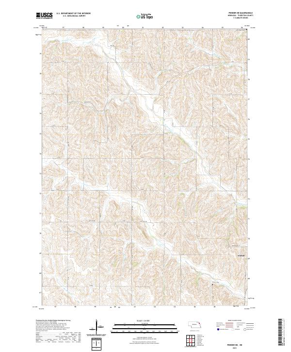
2021 Map of Pender NE
USGS Topo · Published 2021About this map
Walthill occupies the southeastern corner of this landscape, positioned along Balltown Rd and Mathewson ST as the primary local hub. The surrounding terrain is characterized by a dense network of watercourses that have shaped the agricultural grid, including the winding N Omaha Cr and Morgan Cr. These drainages create a complex series of valleys and ridges, breaking the typical Midwestern regularity seen in local thoroughfares like The Strip Rd and Emerson Rd.
Find a feature on this map
31 named features on this map. Tap any name to fly to it.
Don’t see what you’re looking for? This feature index may not catch every label — zoom into the map to look around manually.
Map Details
Editions of this 2021 Pender NE Map
This is the sole edition of this map. No revisions or reprints were ever made.
Other maps of this area

1955 · Sioux City
USGS Topo · 1:250,000

1958 · Sioux City
USGS Topo · 1:250,000

1959 · Sioux City
USGS Topo · 1:250,000

1964 · Homer
USGS Topo · 1:24,000

1966 · Walthill SW
USGS Topo · 1:24,000

1966 · Walthill
USGS Topo · 1:24,000
1966 · Bancroft
USGS Topo · 1:24,000

1966 · Thurston
USGS Topo · 1:24,000

1966 · Pender NE
USGS Topo · 1:24,000
1966 · Pender
USGS Topo · 1:24,000