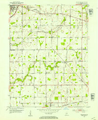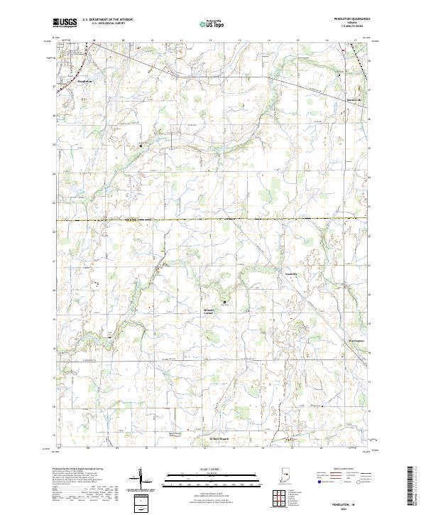
1966 Map of Pendleton
USGS Topo · Published 1968About this map
Fall Creek and its many tributaries, including Spring Branch and Lick Creek, define the rural landscape of southern Madison County in the mid-1960s. The town of Pendleton anchors the northwest corner along the Penn Central railroad, while smaller agricultural hubs like Milners Corner, Warrington, and Willow Branch dot the countryside. This map reflects a well-established grid of country roads, many named for local families or destinations like Nashville Road, connecting numerous small rural institutions. Genealogists will find a wealth of specific landmarks, from the Fall Creek Meetinghouse to a high density of small burial grounds such as Busby Cem, Walker Cem, and Hays Cem. The southern reach follows the winding path of Sugar Creek, where the terrain transitions toward a Peat Bog and the scattered woodlots of Brown and Green townships.
Find a feature on this map
32 named features on this map. Tap any name to fly to it.
Don’t see what you’re looking for? This feature index may not catch every label — zoom into the map to look around manually.
Map Details
Editions of this 1966 Pendleton Map
This is the sole edition of this map. No revisions or reprints were ever made.
Historical Maps of Pendleton Through Time
7 maps found