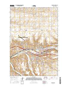
2017 Map of Pendleton
USGS Topo · Published 2017About this map
The Umatilla River serves as the central artery for this region of Umatilla County, where the settlement of Pendleton anchors the local landscape. The map illustrates a developed corridor following the river valley, with the western community of Rieth and the residential area of Pendair Heights positioned near the Eastern Oregon Regional Airport at Pendleton. Higher ground is marked by features like Owen Hill, while the valley floor is defined by a network of drainage systems including McKay Creek and Wildhorse Creek.
Find a feature on this map
107 named features on this map. Tap any name to fly to it.
Don’t see what you’re looking for? This feature index may not catch every label — zoom into the map to look around manually.
Map Details
Editions of this 2017 Pendleton Map
This is the sole edition of this map. No revisions or reprints were ever made.
Other maps of this area

1935 · Pendleton
USGS Topo · 1:125,000

1953 · Pendleton
USGS Topo · 1:250,000

1956 · Pendleton
USGS Topo · 1:250,000

1966 · Mc Kay Reservoir
USGS Topo · 1:24,000

1966 · Holdman
USGS Topo · 1:24,000

1966 · Holdman SE
USGS Topo · 1:24,000

1966 · Table Rock
USGS Topo · 1:24,000

1966 · Pendleton
USGS Topo · 1:24,000

1966 · Mission
USGS Topo · 1:24,000
1966 · Helix
USGS Topo · 1:24,000