
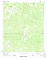
1972 Map of Penfield
USGS Topo · Published 1973About this map
Penfield serves as a central hub for this portion of Greene County, marked by the presence of Old Mercer Chapel and several outlying rural settlements. The landscape transitions from the residential clusters of Maxeys and Woodville into the sprawling wooded acreage of the Oconee National Forest. This era in middle Georgia is characterized by a high density of small community landmarks, particularly churches and family burial grounds such as Bethabara Ch, Macedonia Ch, and the Janes Cem. A network of waterways including Fishing Creek and McWhorter Creek carves through the terrain, illustrating the historical reliance on these natural drainage systems for local property boundaries and early transportation routes. The map records the intersection of rural life and federal land management just north of the Oglethorpe County and Greene County line.
Find a feature on this map
25 named features on this map. Tap any name to fly to it.
Don’t see what you’re looking for? This feature index may not catch every label — zoom into the map to look around manually.
Map Details
Editions of this 1972 Penfield Map
2 editions found
Other maps of this area

1953 · Athens
USGS Topo · 1:250,000

1958 · Athens
USGS Topo · 1:250,000

1959 · Athens
USGS Topo · 1:250,000

1963 · Athens
USGS Topo · 1:250,000

1964 · Barnett Shoals
USGS Topo · 1:24,000

1965 · Woodville
USGS Topo · 1:24,000

1965 · Union Point
USGS Topo · 1:24,000

1971 · Maxeys
USGS Topo · 1:24,000
1971 · Lexington
USGS Topo · 1:24,000

1972 · Buckhead
USGS Topo · 1:24,000