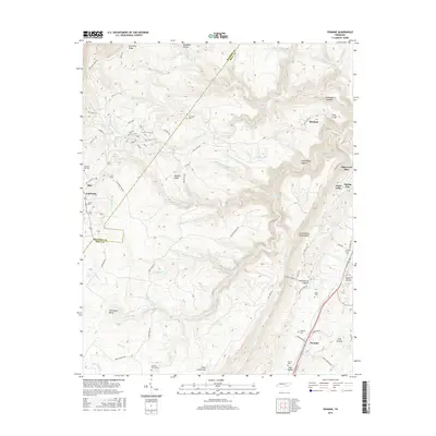
2016 Map of Pennine
USGS Topo · Published 2016About this map
Pennine and the surrounding plateau of Walden Ridge define this landscape on the eastern edge of the Cumberland Escarpment. The settlement of Spring City occupies the lower elevations to the east, where the terrain transitions from the steep ridges and hollows like Dead Negro Hollow and Schoolhouse Hollow into the Ideal Valley. The high ground is marked by numerous family and community burial sites, including Wassom Cem, Thurman Cem, and Winnie Cem, which are scattered among the headwaters of the Stinging Fork and Soak Cr. A dramatic geographic feature, the Horseshoe Bend of Moccasin Cr, lies in the southern portion of the sheet near Clear Creek Gulf. The map records a complex drainage system where waters from Bumbee Cr and Piney Cr cut through the rugged sandstone caprock, creating significant elevation changes that include the Stinging Fork Falls.
Find a feature on this map
95 named features on this map. Tap any name to fly to it.
Don’t see what you’re looking for? This feature index may not catch every label — zoom into the map to look around manually.
Map Details
Editions of this 2016 Pennine Map
This is the sole edition of this map. No revisions or reprints were ever made.
Other maps of this area

1887 · Kingston
USGS Topo · 1:125,000

1891 · Kingston
USGS Topo · 1:125,000

1892 · Pikeville
USGS Topo · 1:125,000

1893 · Kingston
USGS Topo · 1:125,000

1895 · Pikeville
USGS Topo · 1:125,000

1909 · Sequatchie Valley
USGS Topo · 1:62,500

1910 · Pikeville
USGS Topo · 1:62,500

1912 · Crossville
USGS Topo · 1:62,500

1935 · Melvine
USGS Topo · 1:24,000

1935 · Morgan Springs
USGS Topo · 1:24,000