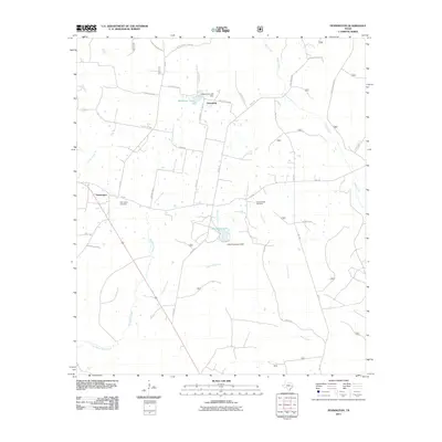
2011 Map of Pennington
USGS Topo · Published 2011About this map
The community of Pennington serves as the primary focal point of this East Texas survey, situated along the crossroads of FM-358 and 287. The landscape is defined by its intricate drainage network, where Brownlee Creek and Louisville Creek flow through the central terrain toward Little White Rock Creek in the south. These watercourses are vital to the local geography, supporting the creation of reservoirs like Westbrook Lake and Lake Pennington, the latter held by the Lake Pennington Dam.
Find a feature on this map
52 named features on this map. Tap any name to fly to it.
Don’t see what you’re looking for? This feature index may not catch every label — zoom into the map to look around manually.
Map Details
Editions of this 2011 Pennington Map
This is the sole edition of this map. No revisions or reprints were ever made.
Other maps of this area

1950 · Centralia
USGS Topo · 1:24,000

1951 · Kennard
USGS Topo · 1:24,000

1951 · Centralia
USGS Topo · 1:24,000

1951 · Berea
USGS Topo · 1:24,000

1953 · Palestine
USGS Topo · 1:250,000

1957 · Palestine
USGS Topo · 1:250,000

1962 · Glendale
USGS Topo · 1:24,000

1963 · Crecy
USGS Topo · 1:24,000

1963 · Groveton West
USGS Topo · 1:24,000
1963 · Pennington
USGS Topo · 1:24,000