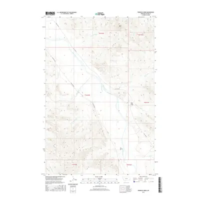
2017 Map of Pennock Creek
USGS Topo · Published 2017About this map
The Powder River carves a broad valley through the center of this Custer County landscape, serving as the primary drainage for numerous seasonal tributaries. To the north, Baldy Butte rises above the surrounding terrain, overlooking the confluence of Pennock Creek and its many feeder branches like Tiger Jim Cr and Cottonwood Cr. The map documents a sparse, open ranching and grazing territory where movement is dictated by the river and the established routes of Powder River Rd and Trail Creek Rd. The Mason Creek Bridge provides a critical crossing over the Mason Cr drainage, while features such as Cut Coulee and Devils Hole Cr illustrate the eroded, topographically diverse character of the southeastern corner of the quadrangle near the boundary of t5n r53e.
Find a feature on this map
23 named features on this map. Tap any name to fly to it.
Don’t see what you’re looking for? This feature index may not catch every label — zoom into the map to look around manually.
Map Details
Editions of this 2017 Pennock Creek Map
This is the sole edition of this map. No revisions or reprints were ever made.
Other maps of this area

1953 · Miles City
USGS Topo · 1:250,000

1957 · Miles City
USGS Topo · 1:250,000

1958 · Miles City
USGS Topo · 1:250,000

1969 · Mizpah
USGS Topo · 1:24,000

1969 · Knowlton
USGS Topo · 1:24,000

1969 · Forty Creek
USGS Topo · 1:24,000

1969 · Tepee Butte NE
USGS Topo · 1:24,000

1969 · Locate SE
USGS Topo · 1:24,000

1969 · Tepee Butte
USGS Topo · 1:24,000
1969 · Pennock Creek
USGS Topo · 1:24,000