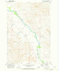
1969 Map of Pennock Creek
USGS Topo · Published 1973About this map
The Powder River meanders through this portion of Custer County, shaping a landscape defined by sharp coulees and intermittent stream beds. This late 1960s survey captures a rural Montana environment where water management is central to the land's utility, evidenced by several Flowing Wells dotting the drainages. In the southern reaches, the Trail Creek Sch and a nearby Grave mark the locations of early settlement and community life along the cattle-country trails. Movement across the terrain is traced through established paths like the Cut Trail and various unnamed jeep trails that navigate the breaks between Pennock Creek and Tiger Creek. Rising above the surrounding draws, Baldy Butte serves as a prominent natural landmark in a territory dissected by numerous small tributaries including Devils Hole Creek and Cottonwood Creek.
Find a feature on this map
21 named features on this map. Tap any name to fly to it.
Don’t see what you’re looking for? This feature index may not catch every label — zoom into the map to look around manually.
Map Details
Editions of this 1969 Pennock Creek Map
This is the sole edition of this map. No revisions or reprints were ever made.
Other maps of this area

1953 · Miles City
USGS Topo · 1:250,000

1957 · Miles City
USGS Topo · 1:250,000

1958 · Miles City
USGS Topo · 1:250,000

1969 · Mizpah
USGS Topo · 1:24,000

1969 · Knowlton
USGS Topo · 1:24,000

1969 · Forty Creek
USGS Topo · 1:24,000

1969 · Tepee Butte NE
USGS Topo · 1:24,000

1969 · Locate SE
USGS Topo · 1:24,000

1969 · Tepee Butte
USGS Topo · 1:24,000
1969 · Red Knob
USGS Topo · 1:24,000