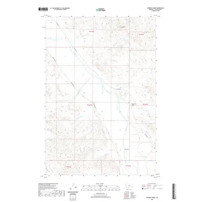
2020 Map of Pennock Creek
USGS Topo · Published 2020About this map
The Powder River carves a broad valley through this section of Custer County, serving as the central geographic feature for a network of ephemeral drainages and intermittent streams. This 2020 landscape is defined by the erosion patterns typical of the region, where landforms such as Baldy Butte and Cut Coulee rise above the surrounding flats. The map records the essential infrastructure for navigating this ranching country, notably the Mason Creek Bridge and long stretches of Powder River Rd. Numerous named tributaries like Pennock Cr, Mason Cr, and Tiger Tom Cr reach into the upland areas, illustrating how the drainage system dictates the placement of transit routes such as Trail Creek Rd. The survey provides a clear view of the land divisions across several townships, capturing the modern state of this river-cut terrain.
Find a feature on this map
24 named features on this map. Tap any name to fly to it.
Don’t see what you’re looking for? This feature index may not catch every label — zoom into the map to look around manually.
Map Details
Editions of this 2020 Pennock Creek Map
This is the sole edition of this map. No revisions or reprints were ever made.
Other maps of this area

1953 · Miles City
USGS Topo · 1:250,000

1957 · Miles City
USGS Topo · 1:250,000

1958 · Miles City
USGS Topo · 1:250,000

1969 · Mizpah
USGS Topo · 1:24,000

1969 · Knowlton
USGS Topo · 1:24,000

1969 · Forty Creek
USGS Topo · 1:24,000

1969 · Tepee Butte NE
USGS Topo · 1:24,000

1969 · Locate SE
USGS Topo · 1:24,000

1969 · Tepee Butte
USGS Topo · 1:24,000
1969 · Pennock Creek
USGS Topo · 1:24,000