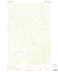
1989 Map of Penobscot Farm
USGS Topo · Published 1989About this map
The West Branch Penobscot River winds through this Piscataquis County landscape, a region defined by its timber-industry infrastructure and deep-woods outposts. The Golden Road, a vital private hauling artery, cuts across the terrain, connecting remote reaches of the Maine woods. Historical human presence is marked by sites like the Smith Halfway House (Site) and Penobscot Farm, while Hannibals Crossing provides a key point of transit across the river. The southern portion of the survey is dominated by the complex hydrology of Lobster Lake and Little Lobster Lake, joined by Lobster Stream. This map captures a working forest at the end of the 1980s, where the network of logging roads and named streams like Moosehorn Stream and Ragmuff Stream reveal the intricate layout of these northern townships.
Find a feature on this map
18 named features on this map. Tap any name to fly to it.
Don’t see what you’re looking for? This feature index may not catch every label — zoom into the map to look around manually.
Map Details
Editions of this 1989 Penobscot Farm Map
2 editions found
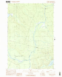
Other maps of this area

1954 · Chesuncook
USGS Topo · 1:62,500

1954 · North East Carry
USGS Topo · 1:62,500

1954 · Caucomgomoc Lake
USGS Topo · 1:62,500

1954 · Grant Farm
USGS Topo · 1:62,500

1954 · Presque Isle
USGS Topo · 1:250,000

1954 · Millinocket
USGS Topo · 1:250,000

1958 · Presque Isle
USGS Topo · 1:250,000

1958 · Millinocket
USGS Topo · 1:250,000

1958 · Chesuncook
USGS Topo · 1:62,500

1958 · Caucomgomoc Lake
USGS Topo · 1:62,500
Featured Places
- Northeast Carry Township, ME
- T4 R14 WELS, ME
- Lobster Township, ME
- T4 R15 WELS, ME
- Piscataquis County, ME