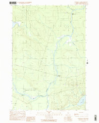
1989 Map of Penobscot Farm
USGS Topo · Published 1989About this map
The West Branch Penobscot River snakes through this Piscataquis County landscape, a region defined by its timber and river history in the late twentieth century. In the northern reaches, the Smith Halfway House (Site) stands as a marker of the historic stopping points used during the era of river drives and northern Maine exploration. The terrain is marked by the complex intersection of waterways, including Lobster Stream and the wide expanse of the Cassidy Deadwater, illustrating the natural drainage patterns of the Maine woods before significant modern development. The Golden Road cuts through the township of North East Carry, serving as a primary artery for the local logging economy. To the south, the namesake Penobscot Farm and the remote outpost at Hannibals Crossing provide evidence of the scattered settlements and administrative sites that supported forestry operations and outdoor recreation near Little Lobster Lake.
Find a feature on this map
19 named features on this map. Tap any name to fly to it.
Don’t see what you’re looking for? This feature index may not catch every label — zoom into the map to look around manually.
Map Details
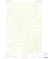
Editions of this 1989 Penobscot Farm Map
2 editions found
Other maps of this area

1954 · Chesuncook
USGS Topo · 1:62,500

1954 · North East Carry
USGS Topo · 1:62,500

1954 · Caucomgomoc Lake
USGS Topo · 1:62,500

1954 · Grant Farm
USGS Topo · 1:62,500

1954 · Presque Isle
USGS Topo · 1:250,000

1954 · Millinocket
USGS Topo · 1:250,000

1958 · Presque Isle
USGS Topo · 1:250,000

1958 · Millinocket
USGS Topo · 1:250,000

1958 · Chesuncook
USGS Topo · 1:62,500

1958 · Caucomgomoc Lake
USGS Topo · 1:62,500
Featured Places
- Northeast Carry Township, ME
- T4 R14 WELS, ME
- Lobster Township, ME
- T4 R15 WELS, ME
- Piscataquis County, ME