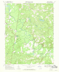
1969 Map of Penola
USGS Topo · Published 1970About this map
The Mattaponi River meanders through this landscape in Caroline County, characterized by a network of swampy lowlands like Tanyard Swamp and Boot Swamp. This 1960s survey documents a rural topography where local commerce and community life centered on intersections and water power, evidenced by small settlements like Shumansville and the milling sites at Campbells Millpond and Reedy Millpond. The western edge of the quadrangle is defined by the critical transit corridor of the Richmond Fredericksburg and Potomac railroad, which served the community of Penola. Family-named landmarks such as Chenaults Shop, Doggetts Fork, and Kidds Fork offer specific geographical points for genealogists tracing local history, while several country churches, including Mt Hermon Ch and Holy Trinity Ch, mark the spiritual hubs of these scattered woodland and farming communities.
Find a feature on this map
38 named features on this map. Tap any name to fly to it.
Don’t see what you’re looking for? This feature index may not catch every label — zoom into the map to look around manually.
Map Details
Editions of this 1969 Penola Map
2 editions found
Other maps of this area

1889 · Fredericksburg
USGS Topo · 1:125,000

1892 · Fredericksburg
USGS Topo · 1:125,000

1894 · Fredericksburg
USGS Topo · 1:125,000

1918 · Doswell
USGS Topo · 1:62,500

1918 · Aylett
USGS Topo · 1:62,500

1933 · Aylett
USGS Topo · 1:62,500

1942 · Bowling Green
USGS Topo · 1:31,680

1942 · Upper Zion
USGS Topo · 1:31,680

1942 · Woodford
USGS Topo · 1:31,680

1943 · Richmond
USGS Topo · 1:250,000