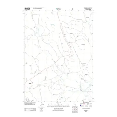
2012 Map of Penoyar
USGS Topo · Published 2012About this map
Hoffman Mill and the seasonal drainages of the Siskiyou high country define this section of Northern California. The landscape is marked by a network of forest routes such as Tenant Rd and Forest Rte 70, which connect isolated outposts like Penoyar and Erickson. The terrain shifts from the elevations of Hebron Summit and Mount Hebron down toward the flats near Butte Cr. Geographic landmarks with colorful local identifiers, including Dead Steer Flat and Devils Gate, suggest a history of cattle ranching and early mountain passage. Industrial and agricultural footprints are visible at Soule Ranch and Leaf Camp, while water features like Pumpkinseed Lake and Horsethief Cr provide the primary hydrological structure for the region.
Find a feature on this map
25 named features on this map. Tap any name to fly to it.
Don’t see what you’re looking for? This feature index may not catch every label — zoom into the map to look around manually.
Map Details
Editions of this 2012 Penoyar Map
This is the sole edition of this map. No revisions or reprints were ever made.
Other maps of this area

1886 · Modoc Lava Bed
USGS Topo · 1:250,000

1886 · Shasta
USGS Topo · 1:250,000

1892 · Modoc Lava-Bed
USGS Topo · 1:250,000

1894 · Shasta
USGS Topo · 1:250,000

1934 · Macdoel
USGS Topo · 1:96,000

1941 · Macdoel
USGS Topo · 1:125,000

1948 · Weed
USGS Topo · 1:250,000

1950 · Weed
USGS Topo · 1:250,000

1950 · Bray
USGS Topo · 1:62,500

1950 · Dorris
USGS Topo · 1:62,500