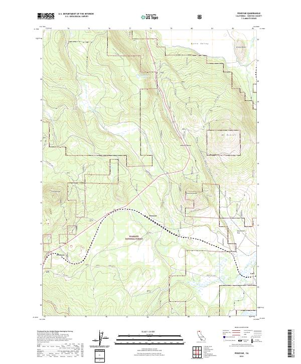
2021 Map of Penoyar
USGS Topo · Published 2021About this map
Klamath National Forest dominates the southern landscape of this Siskiyou County region, where the high desert terrain of the Butte Valley meets timbered volcanic uplands. The small settlements of Penoyar, Erickson, and Leaf are positioned along the primary transportation corridors, including a stretch of the Old State Hwy. This 2021 survey illustrates a complex network of forestry roads and trails, such as the Deer Mtn Long Loop Trl, which navigate the slopes of Little Deer Mtn and Mt Hebron. Hydrological features are sparse but significant in this arid environment, marked by the presence of Pumpkinseed Lake and Horsethief Cr. Distinctive landmarks like Jerome Butte and the curiously named Dead Steer Flat provide clear reference points for those studying the land use and topography of this northern California corridor.
Find a feature on this map
30 named features on this map. Tap any name to fly to it.
Don’t see what you’re looking for? This feature index may not catch every label — zoom into the map to look around manually.
Map Details
Editions of this 2021 Penoyar Map
This is the sole edition of this map. No revisions or reprints were ever made.
Other maps of this area

1886 · Modoc Lava Bed
USGS Topo · 1:250,000

1886 · Shasta
USGS Topo · 1:250,000

1892 · Modoc Lava-Bed
USGS Topo · 1:250,000

1894 · Shasta
USGS Topo · 1:250,000

1934 · Macdoel
USGS Topo · 1:96,000

1941 · Macdoel
USGS Topo · 1:125,000

1948 · Weed
USGS Topo · 1:250,000

1950 · Weed
USGS Topo · 1:250,000

1950 · Bray
USGS Topo · 1:62,500

1950 · Dorris
USGS Topo · 1:62,500