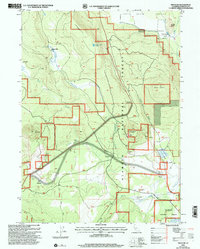
2001 Map of Penoyar
USGS Topo · Published 2004About this map
Mount Hebron and the surrounding high desert terrain dominate this Siskiyou County landscape at the start of the 21st century. The map provides a look at the land use within the Klamath National Forest, where industrial footprints such as several Cinder Pits and a Quarry sit alongside natural landmarks like Horsethief Butte and Little Deer Mtn. Cultural history is preserved through the marking of former locations, including the Hoffman Mill (Site) and Soule Ranch (Site). Drainage patterns are clearly defined by Horsethief Creek and Butte Creek, while isolated outposts like Davis Cabin and the rail-aligned points of Penoyar, Erickson, and Leaf highlight the sparse but strategic human footprint in this volcanic region.
Find a feature on this map
29 named features on this map. Tap any name to fly to it.
Don’t see what you’re looking for? This feature index may not catch every label — zoom into the map to look around manually.
Map Details
Editions of this 2001 Penoyar Map
This is the sole edition of this map. No revisions or reprints were ever made.
Other maps of this area

1886 · Modoc Lava Bed
USGS Topo · 1:250,000

1886 · Shasta
USGS Topo · 1:250,000

1892 · Modoc Lava-Bed
USGS Topo · 1:250,000

1894 · Shasta
USGS Topo · 1:250,000

1934 · Macdoel
USGS Topo · 1:96,000

1941 · Macdoel
USGS Topo · 1:125,000

1948 · Weed
USGS Topo · 1:250,000

1950 · Weed
USGS Topo · 1:250,000

1950 · Bray
USGS Topo · 1:62,500

1950 · Dorris
USGS Topo · 1:62,500