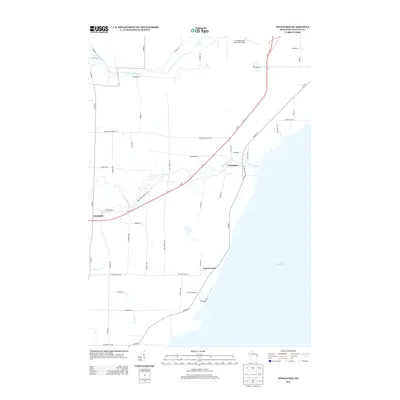
2013 Map of Pensaukee
USGS Topo · Published 2013About this map
Pensaukee sits at the confluence of the Pensaukee River and the western shore of Lake Michigan, serving as a primary focal point of this Oconto County landscape. The area is defined by its complex drainage systems, where the Oconto River and Little River wind through the northern territory, while smaller waterways like Brookside Cr and Kirchner Cr cut through the coastal lowlands. The settlement pattern is largely agricultural and residential, with clusters of activity at Brookside and Oak Orchard.
Find a feature on this map
51 named features on this map. Tap any name to fly to it.
Don’t see what you’re looking for? This feature index may not catch every label — zoom into the map to look around manually.
Map Details
Editions of this 2013 Pensaukee Map
This is the sole edition of this map. No revisions or reprints were ever made.
Other maps of this area

1954 · New Franken
USGS Topo · 1:62,500

1954 · Manitowoc
USGS Topo · 1:250,000

1954 · Green Bay
USGS Topo · 1:62,500

1955 · Green Bay
USGS Topo · 1:250,000

1956 · Oconto
USGS Topo · 1:62,500

1956 · Oconto Falls
USGS Topo · 1:62,500

1958 · Manitowoc
USGS Topo · 1:250,000
1974 · Oconto East
USGS Topo · 1:24,000

1974 · Abrams
USGS Topo · 1:24,000
1974 · Lena
USGS Topo · 1:24,000