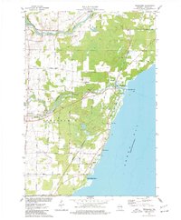
1974 Map of Pensaukee
USGS Topo · Published 1977About this map
The Oconto River and Pensaukee River empty into the western waters of Green Bay, defining a landscape of low-lying marshes and coastal lowlands in the mid-1970s. This survey captures the rural character of Oconto County, where small settlements like Pensaukee and Brookside serve as local hubs for a network of family-named roads, including Liegeois Road and Huebscher Road. The Chicago and North Western railroad corridor runs parallel to the shoreline, facilitating the movement of goods through the region's agricultural and industrial sites, such as the numerous quarries located near the coast.
Find a feature on this map
41 named features on this map. Tap any name to fly to it.
Don’t see what you’re looking for? This feature index may not catch every label — zoom into the map to look around manually.
Map Details
Editions of this 1974 Pensaukee Map
This is the sole edition of this map. No revisions or reprints were ever made.
Other maps of this area

1954 · New Franken
USGS Topo · 1:62,500

1954 · Manitowoc
USGS Topo · 1:250,000

1954 · Green Bay
USGS Topo · 1:62,500

1955 · Green Bay
USGS Topo · 1:250,000

1956 · Oconto
USGS Topo · 1:62,500

1956 · Oconto Falls
USGS Topo · 1:62,500

1958 · Manitowoc
USGS Topo · 1:250,000
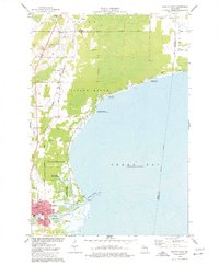
1974 · Oconto East
USGS Topo · 1:24,000

1974 · Abrams
USGS Topo · 1:24,000
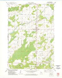
1974 · Lena
USGS Topo · 1:24,000