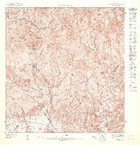
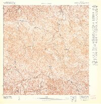
1947 Map of Penuelas NO
USGS Topo · Published 1947About this map
Bosque Insular de Guilarte dominates this high-altitude landscape along the Cordillera Central, where the steep drainage of the southern slopes is harnessed for power. The 1940s infrastructure is centered on the Salto Garzas Planta Hidroelectrica No 1 and Planta Hidroelectrica No 2, illustrating the era's focus on hydroelectric development in the island's interior. Scattered mountain settlements like Mata de Plátano and Rucio are connected by a network of winding roads and trails that follow the complex ridgelines. The map clearly defines the high-country boundary between the Municipio de Adjuntas and Municipio de Peñuelas, tracing the divide where the headwaters of the Río Guayanés and Río Tallaboa begin their descent toward the coast.
Find a feature on this map
11 named features on this map. Tap any name to fly to it.
Don’t see what you’re looking for? This feature index may not catch every label — zoom into the map to look around manually.
Map Details
Editions of this 1947 Penuelas NO Map
This is the sole edition of this map. No revisions or reprints were ever made.
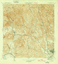
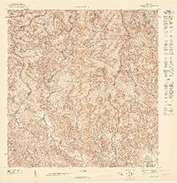
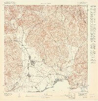
Other maps of this area

1946 · Yauco
USGS Topo · 1:30,000

1946 · Monte Guilarte
USGS Topo · 1:30,000
1946 · Penuelas
USGS Topo · 1:30,000

1946 · Adjuntas
USGS Topo · 1:30,000
1947 · Yauco NE
USGS Topo · 1:10,000
1947 · Yauco SE
USGS Topo · 1:10,000

1947 · Penuelas NE
USGS Topo · 1:10,000

1947 · Adjuntas SO
USGS Topo · 1:10,000
1947 · Monte Guilarte SE
USGS Topo · 1:10,000
1947 · Penuelas SO
USGS Topo · 1:10,000