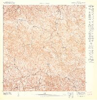
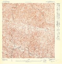
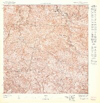
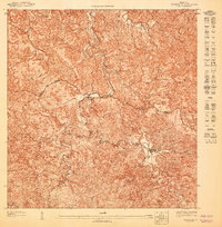
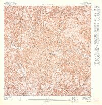
1947 Map of Monte Guilarte SE
USGS Topo · Published 1947About this map
The high-altitude coffee country of central Puerto Rico is defined by the steep slopes and narrow river valleys within the Bosque Insular de Guilarte. In the late 1940s, the agricultural economy centered on established haciendas, which are densely distributed across this landscape. Significant estates include Hacienda Esperanza, Hacienda Bianchi, and Hacienda Monserrate, each situated to manage the complex drainage basins of the Rio Yahuecas and Rio Guilarte.
Find a feature on this map
32 named features on this map. Tap any name to fly to it.
Don’t see what you’re looking for? This feature index may not catch every label — zoom into the map to look around manually.
Map Details
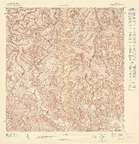
Editions of this 1947 Monte Guilarte SE Map
This is the sole edition of this map. No revisions or reprints were ever made.
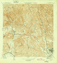
Other maps of this area

1946 · Yauco
USGS Topo · 1:30,000

1946 · Monte Guilarte
USGS Topo · 1:30,000
1946 · Penuelas
USGS Topo · 1:30,000

1946 · Adjuntas
USGS Topo · 1:30,000
1947 · Yauco NE
USGS Topo · 1:10,000
1947 · Monte Guilarte NE
USGS Topo · 1:10,000
1947 · Monte Guilarte SO
USGS Topo · 1:10,000
1947 · Adjuntas NO
USGS Topo · 1:10,000

1947 · Adjuntas SO
USGS Topo · 1:10,000
1947 · Yauco NO
USGS Topo · 1:10,000