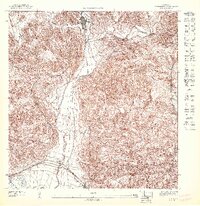
1947 Map of Penuelas SO
USGS Topo · Published 1947About this map
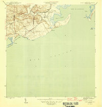
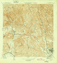
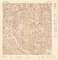
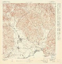
Peñuelas sits at the northern edge of this coastal valley, where the rugged topography of the southern cordillera meets the agricultural lowlands. The 1943 topography reveals a landscape transitioning from the steep, clustered contours of the hills to the managed lands of Hacienda Dolores. Transportation in this era was dominated by the American Railroad of Porto Rico, which traces the coastline and connects the settlements of Tallaboa and Seboruco. The drainage patterns of the Rio Tallaboa and Guayanés define the fertile corridors between the heights, providing a clear view of the regional water system before mid-century development. This preliminary survey, published by the U.S. Geological Survey in cooperation with the Gobierno de Puerto Rico, captures the rural character of the municipality when sugar estates and rail lines were the primary drivers of the local economy.
Find a feature on this map
9 named features on this map. Tap any name to fly to it.
Don’t see what you’re looking for? This feature index may not catch every label — zoom into the map to look around manually.
Map Details
Editions of this 1947 Penuelas SO Map
This is the sole edition of this map. No revisions or reprints were ever made.
Other maps of this area

1946 · Punta Cuchara
USGS Topo · 1:30,000

1946 · Yauco
USGS Topo · 1:30,000
1946 · Punta Verraco
USGS Topo · 1:30,000
1946 · Penuelas
USGS Topo · 1:30,000
1947 · Yauco NE
USGS Topo · 1:10,000

1947 · Punta Gughara NE
USGS Topo · 1:10,000
1947 · Yauco SE
USGS Topo · 1:10,000

1947 · Penuelas NE
USGS Topo · 1:10,000
1947 · Punta Verraco NE
USGS Topo · 1:10,000
1947 · Penuelas NO
USGS Topo · 1:10,000