1947 Map of Punta Verraco NE
USGS Topo · Published 1947About this map
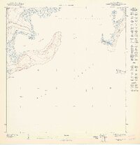
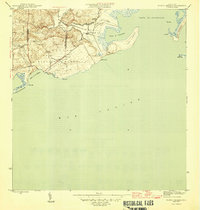
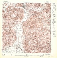
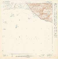
Punta Verraco extends into the Mar Caribe along the southern coast of Puerto Rico in this 1947 topographic study. The landscape is defined by the sheltered waters of the Puerto de Guayanilla and the Bahia de Guayanilla, where the Río Yauco meets the sea. This preliminary survey, commissioned by Orlando R. Méndez, illustrates the coastal topography just before the mid-century industrial developments in the region. The map details natural landforms including Cerro Toro and several offshore features such as Cayo Mata and Cayo María Langa. Significant coastal points like Pta Ventana and Punta Guayanilla delineate the jagged shoreline, providing a clear record of the shoreline and coastal elevations prior to later modernization.
Find a feature on this map
11 named features on this map. Tap any name to fly to it.
Don’t see what you’re looking for? This feature index may not catch every label — zoom into the map to look around manually.
Map Details
Editions of this 1947 Punta Verraco NE Map
This is the sole edition of this map. No revisions or reprints were ever made.
Other maps of this area

1946 · Punta Cuchara
USGS Topo · 1:30,000

1946 · Yauco
USGS Topo · 1:30,000
1946 · Punta Verraco
USGS Topo · 1:30,000
1946 · Penuelas
USGS Topo · 1:30,000
1947 · Yauco SE
USGS Topo · 1:10,000

1947 · Yauco SO
USGS Topo · 1:10,000
1947 · Penuelas SO
USGS Topo · 1:10,000
1947 · Punta Gughara NO
USGS Topo · 1:10,000

1952 · Punta Cuchara
USGS Topo · 1:30,000
1952 · Penuelas
USGS Topo · 1:30,000