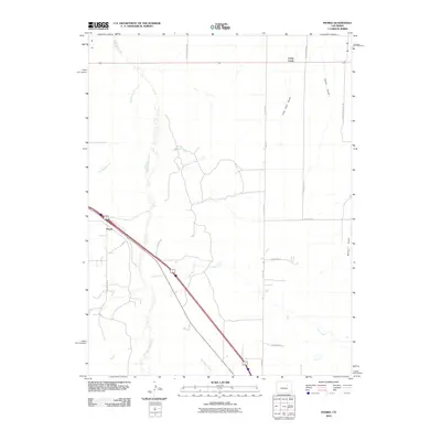
2010 Map of Peoria
USGS Topo · Published 2010About this map
Peoria anchors this eastern Colorado landscape, situated along the diagonal path of the interstate as it cuts across a network of intermittent waterways. The terrain is defined by the braided drainage patterns of Middle Bijou Creek and East Bijou Creek, which flow northward toward the Platte River basin. This high plains environment is etched with numerous named features that reveal the local topography and historical land use, including Lone Tree Gulch, Cabin Gulch, and Bolean Gulch.
Find a feature on this map
20 named features on this map. Tap any name to fly to it.
Don’t see what you’re looking for? This feature index may not catch every label — zoom into the map to look around manually.
Map Details
Editions of this 2010 Peoria Map
This is the sole edition of this map. No revisions or reprints were ever made.
Other maps of this area

1951 · Leader SE
USGS Topo · 1:24,000

1952 · Leader SW
USGS Topo · 1:24,000

1953 · Denver
USGS Topo · 1:250,000

1954 · Limon
USGS Topo · 1:250,000

1956 · Peoria
USGS Topo · 1:24,000

1956 · Byers
USGS Topo · 1:24,000

1957 · Denver
USGS Topo · 1:250,000

1957 · Limon
USGS Topo · 1:250,000

1958 · Limon
USGS Topo · 1:250,000

1958 · Denver
USGS Topo · 1:250,000