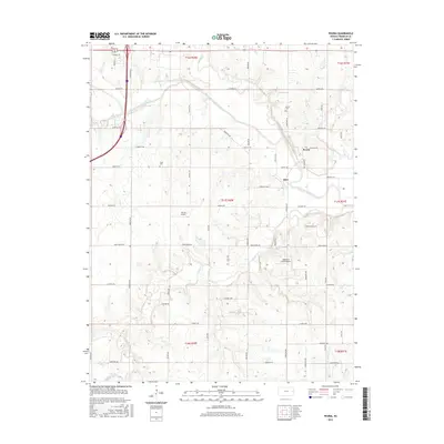
2015 Map of Peoria
USGS Topo · Published 2015About this map
Peoria anchors this rural landscape in Franklin County, situated south of the Marais des Cygnes River as it meanders through eastern Kansas. The terrain is defined by the gentle drainage of Hickory Creek and Middle Creek, which shape the agricultural grid of the region. This 2015 survey reflects a late twentieth and early twenty-first-century pattern of land use, where established township roads like Kingman Road and Tennessee Road connect isolated farmsteads to the historic center of the Peoria community. The map provides a detailed look at the modern rural infrastructure, showing the persistence of traditional property lines and the importance of localized airfields such as Highland Farm Airport and Harrod Airport in supporting the regional economy.
Find a feature on this map
1 named feature on this map. Tap any name to fly to it.
Don’t see what you’re looking for? This feature index may not catch every label — zoom into the map to look around manually.
Map Details
Editions of this 2015 Peoria Map
This is the sole edition of this map. No revisions or reprints were ever made.
Other maps of this area

1885 · Garnett
USGS Topo · 1:125,000

1885 · Lawrence
USGS Topo · 1:125,000

1889 · Lawrence
USGS Topo · 1:125,000

1894 · Garnett
USGS Topo · 1:125,000

1947 · Lawrence
USGS Topo · 1:250,000

1950 · Lawrence
USGS Topo · 1:250,000

1956 · Wellsville
USGS Topo · 1:24,000

1956 · Ottawa North
USGS Topo · 1:24,000

1956 · Le Loup
USGS Topo · 1:24,000

1956 · Ottawa South
USGS Topo · 1:24,000