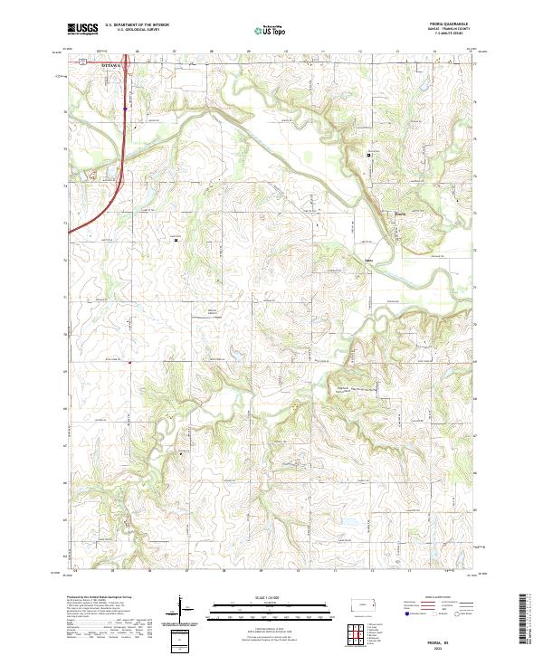
2022 Map of Peoria
USGS Topo · Published 2022About this map
The Marais des Cygnes River winds through this section of Franklin County, defining the agricultural landscape between the eastern edge of Ottawa and the small settlement of Peoria. This rural topography is characterized by the convergence of several waterways, including Middle Cr, Rock Cr, and Ottawa Cr, which have shaped the local drainage and road patterns. The map provides essential detail for family history researchers, documenting the exact locations of Peoria Cem and Fouts Cem.
Find a feature on this map
48 named features on this map. Tap any name to fly to it.
Don’t see what you’re looking for? This feature index may not catch every label — zoom into the map to look around manually.
Map Details
Editions of this 2022 Peoria Map
This is the sole edition of this map. No revisions or reprints were ever made.
Other maps of this area

1885 · Garnett
USGS Topo · 1:125,000

1885 · Lawrence
USGS Topo · 1:125,000

1889 · Lawrence
USGS Topo · 1:125,000

1894 · Garnett
USGS Topo · 1:125,000

1947 · Lawrence
USGS Topo · 1:250,000

1950 · Lawrence
USGS Topo · 1:250,000

1956 · Wellsville
USGS Topo · 1:24,000

1956 · Ottawa North
USGS Topo · 1:24,000

1956 · Le Loup
USGS Topo · 1:24,000

1956 · Ottawa South
USGS Topo · 1:24,000