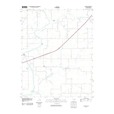
2010 Map of Peoria
USGS Topo · Published 2010About this map
Peoria and Five Mile anchor this northeastern Oklahoma landscape, where the Spring River winds southward toward the headwaters of Grand Lake O' The Cherokees. The map reveals a rural geography defined by a dense grid of section-line roads, including S 630 RD and E 50 RD, which connect scattered settlements like Oak Grove and historical burial sites such as Newman Cemetery and Peoria Cemetery. The terrain is etched by a series of waterways, notably Fivemile Creek and Warren Branch, while distinctive local landmarks like Devils Hollow and the Devils Promenade Bridge highlight the area's natural features. This 2010 survey offers a clear view of the region's transport network just north of the state line, showing how modern infrastructure integrates with the traditional township and range survey system that shaped these communities.
Find a feature on this map
45 named features on this map. Tap any name to fly to it.
Don’t see what you’re looking for? This feature index may not catch every label — zoom into the map to look around manually.
Map Details
Editions of this 2010 Peoria Map
This is the sole edition of this map. No revisions or reprints were ever made.
Other maps of this area

1886 · Joplin
USGS Topo · 1:125,000

1894 · Joplin
USGS Topo · 1:125,000

1907 · Wyandotte
USGS Topo · 1:125,000

1909 · Wyandotte
USGS Topo · 1:125,000

1918 · Columbus
USGS Topo · 1:62,500

1947 · Joplin
USGS Topo · 1:250,000

1949 · Joplin
USGS Topo · 1:250,000

1949 · Seneca
USGS Topo · 1:24,000

1949 · Racine
USGS Topo · 1:24,000

1950 · Seneca
USGS Topo · 1:24,000