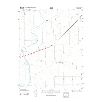
2012 Map of Peoria
USGS Topo · Published 2012About this map
Peoria anchors this northeastern Oklahoma landscape where the agricultural grid meets the winding course of the Spring River. This 2012 survey documents a rural environment shaped by numerous watercourses, including Fivemile Cr and Warren Br, which feed toward the northern reaches of Grand Lake O' the Cherokees. The map highlights several localized settlements like Five Mile and Oak Grove, along with small cemeteries such as Newman Cem and Peoria Cem that serve as vital touchstones for family historians researching the borderlands of Oklahoma and Kansas.
Find a feature on this map
74 named features on this map. Tap any name to fly to it.
Don’t see what you’re looking for? This feature index may not catch every label — zoom into the map to look around manually.
Map Details
Editions of this 2012 Peoria Map
This is the sole edition of this map. No revisions or reprints were ever made.
Other maps of this area

1886 · Joplin
USGS Topo · 1:125,000

1894 · Joplin
USGS Topo · 1:125,000

1907 · Wyandotte
USGS Topo · 1:125,000

1909 · Wyandotte
USGS Topo · 1:125,000

1918 · Columbus
USGS Topo · 1:62,500

1947 · Joplin
USGS Topo · 1:250,000

1949 · Joplin
USGS Topo · 1:250,000

1949 · Seneca
USGS Topo · 1:24,000

1949 · Racine
USGS Topo · 1:24,000

1950 · Seneca
USGS Topo · 1:24,000